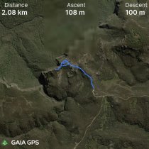
GPS Track Details
| Track length: | 2.78 km |
| Total ascent: | 100 m |
| Total descent: | 93 m |
Blue mountains base camp
10 mins drive down dirt road from Lockleys Pylon. Not a lot of parking spaces. Signage says 1km each way. Takes around 1.5hrs - great views. Once you get to the circular section/rocks - take the right hand track and circle anti clockwise - you can climb to the top if you want - as you do the loops you can continue down alongside the cliff on your right side to some lookout points. Track then continues very steeply and hard to follow. Walk only to first rocky outcrop - not worth continuing. Walk back on other side of hill to view caves. Does not match GPS tracks as we were lost. Image below of suggested walk.


